Login
Login
Franklin and the North West Passage

Share

- Details
- Text
- Audio
- Downloads
- Extra Reading
Due to unforeseen circumstances, Professor Andrew Lambert was unable to give his lecture. Professor Tim Connell kindly gave a lecture in his absence. The next lecture in the series is Heading for trouble: the perils of navigation.
Visit www.seabritain2005.com for information on festivities and events throughout 2005 and beyond. SeaBritain2005 celebrates the ways in which the sea touches all of our lives.
Download Text
FRANKLIN AND THE NORTH WEST PASSAGE
Professor Tim Connell
It is an extremely good day for Gresham College to choose for a lecture on navigation because, in 14 minutes’ time, the Moon will reach its zenith and at 12:27, only just half an hour ago, there was an eclipse of the Sun. This is not, as you might imagine, an example of forward planning by Gresham College. It is quite simply because I was reading my diary from Woolworth’s, which not only contains astronomical data, with full details of the movement of the Moon, but also tells me the names of all British Prime Ministers, when to plant my brassica, and how to get stains out of the carpet! The curious element in all of this is that the information about the phases of the Moon – and you do get diaries which contain tide tables as well – is the kind of information on which people’s lives have depended and (if they don’t have one of those natty little satellite devices) still do. There is also, strangely enough, a City of London connection, because the Stationers’ Company produced almanacs as far back as the 17th Century, the most famous one being Old Moore’s.
The reason we wanted to put Franklin in our series on Navigation is that in the first lecture, we looked literally at navigating by guess and by God. Good old St Brendan, whom we all know discovered America, set off with little more than faith in the Lord, and we suspect a fairly good idea of the constellations in the heavens. 1 From very early times, people knew where the Pole Star was, and people who went to sea must have been pretty good at following stars, given the enormous clarity of the sky at night. One of the subjects which I’d hoped we were going to be able to cover in this series was Pacific navigation. I’m incredibly impressed at how anybody ever found Easter Island, and we do know that Pitcairn Island, having been landed on by the Bounty mutineers, was then lost for nearly twenty years because it was in the wrong place on the map. Yet people on outriggers could travel thousands of miles, and obviously on a regular basis, which I think shows enormous courage, if nothing else, and self-confidence.
Of course Franklin was an interesting man because his naval career started way back at the time of the Napoleonic Wars. He actually served at Copenhagen and Trafalgar as a midshipman 2, (and sailed to Australia with Matthew Flinders and got shipwrecked in between), so he had an eventful career which included three spells of Arctic exploration 3. And his voyages were rewarded not only with a knighthood but also a spell as Governor of the penal colony at Van Diemen’s land, which is modern-day Tasmania 4. So while still a young man he had had plenty of experience of long distance travel, to say the very least. Nautical charts had reached a fairly high level of sophistication by this period. In an earlier lecture we saw the Mediterranean Portolanos, these beautifully illustrated Fourteenth Century maps which were really designed to follow the coast in what, as a landsman, I would call point to point, but which is probably headland to headland navigation. But sailing to Australia was arduous in the extreme and called on a high level of navigational skill. And much of the northern latitudes were still uncharted.
But navigation was by no means haphazard. Latitude was so well known that the Spanish treasure fleets came across the Atlantic twice a year without a great deal of incident unless they ran into British, French or Dutch pirates - and do let’s remember that the French and the Dutch were involved in the free trade as much we were. The Spanish still get terribly excited about Francis Drake, yet he was only one of a band of brothers who took to plundering on the high seas, and to the advantage of the national treasury, in what was effectively an early form of economic warfare. The fleets actually came across on the right latitude with great accuracy. In a Gresham Society lecture the other day, I was rather disappointed to hear the speaker suggest that the British Government was somehow responsible for the breakdown of peace and Spain joining the Napoleonic War on the French side. There was concern that a secret clause in the Treaty of San Ildefonso said that Spain would pass a high percentage of the treasure fleets’ contents to France in order to pursue war with England without declaring war herself. It therefore seemed to be quite a good idea – a pre-emptive strike is not entirely unknown in the modern world – to nobble the Spanish treasure fleet on the way over so that it couldn’t get the money to the French, and the money could then of course be used against Napoleon rather than for him. All the British fleet had to do was to sit on the latitude for Cadiz and just wait for the Spanish treasure fleet to sail into them. 5
The question of longitude, as we saw with some of the navigational instruments last week, was a much tougher issue. I’ve always held Christopher Columbus in great respect as a navigator, because not only did he discover Trinidad, which is obviously a good thing, but he continued by sailing along the coast of Venezuela, and then turned right to go back to Jamaica. Now, it takes enormous courage when you’re sailing along in unknown waters, to say OK, turn right here lads, we’re going back to Jamaica - and they did! The latitude question, even in the 15th Century, would not have been too difficult. Longitude was a risky business, even in the18th Century.
So, by the age we’re looking at today, almost in the period of modern exploration, the Pacific coast had become well known. Some people say that Drake himself discovered San Francisco Bay. (I’m being glared at by someone at the back, so perhaps he didn’t…) The Spanish, even Cortez himself, sent expeditions up and down the Pacific coast and so did Captain Cook, so they knew where Canada finished, except they didn’t know quite how the north of Canada linked to the rest of the world. It’s rather odd, because I always think of the world in terms of a square map, even though the bits showing at the opposite ends on the Mercator projection are actually quite close together. Land exploration westwards had been slow, but Lewis and Clark and the Corps of Discovery in 1803 indicated that there had to be a way across.6 The Hudson’s Bay Company was formed as early as 1670.7There was a fair amount of exploration and there were many fishing fleets using Canadian waters. The Basques were going across to the Grand Banks well before 1492, as were the Portuguese for their salt cod. So those waters were not entirely unknown to navigators like John and Sebastian Cabot.
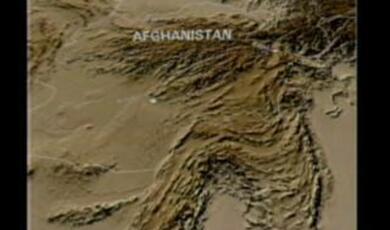
If you look at this intriguing part of the world, Northern Canada breaks up like crazy paving and seems to keep on going up to the roof of the world. I think that you would require enormous patience and an awful lot of good weather to find your way by boat around what looks like a maze or some kind of infernal puzzle. Of course a lot of expeditions did try and they went up dead ends and they were turning left instead of right and couldn’t actually get their way through. The traditional route through to the Pacific was via Panama, though of course it was not until the day before the First World War, August 3 rd 1914, that the Panama Canal itself was opened. Even Nelson as a young captain was sent to Nicaragua to explore ways of digging a canal. There had been attempts to dig a Canal through Panama before, but they were largely stopped by malaria and yellow fever. It was so unhealthy that nobody spent more time in Panama than they really had to. The idea in the days of the Spanish Empire was to sail up to one side, carry the cargo across on muleback, load onto another ship and start off all over again.
Panama, however, did not gain its independence from Spain, as you might expect; it gained its independence from Colombia, as late as 1903. This is partly because the Darien Gap, which you might have seen in your atlases, is actually a natural barrier of swamp and jungle.8 Occasionally there are nature programmes about it because it is the only impenetrable part of the world left. Even the redoubtable Lieutenant Colonel Blashford-Snell tried to get across it in a hovercraft, in the 70s I think it was, but failed to do so 9. Legend has it that when the Panamanians declared Independence, the Colombian Army sailed in from the Caribbean side and wanted to cross the Isthmus by train in order to occupy Panama City. However, the station master, being of a patriotic disposition, insisted on selling a ticket to every single soldier, who discovered that they didn’t have any cash on them. He therefore wouldn’t let them on the train – and the rest is history! (I have a book, published in 1912, which recounts this story, so it must be true…) I think this unknown Panamanian patriot really must go down as an inspiration to South West Trains, because they’ve got people like him at Surbiton station to this day. But I digress.
Franklin’s exploits take place in the 1840s, quite a modern period in history, though people and ships are still being lost at sea. They’re still setting out and not necessarily getting there. The Lutine bell down at Lloyds was still being rung with some frequency, because once ships were over the horizon, they might or might not ever be sighted again.
Franklin knew these waters. He had carried out explorations before as a young officer. He obviously had a penchant for exploration as he was well known in exploration circles, and it therefore made sense that he should lead this final expedition, even though he was in his sixties, not the sort of age you’d expect to set off and start trying to discover things. The ships he was given, the Erebus and Terror, were first class modern warships. He would have had the kind of navigational instruments which we saw last week. He would have had a fairly good set of charts, and he would of course have been able to find both latitude and longitude without too much difficulty. The question arises as to whether he always could, and whether the charts and instruments survived, considering how long these ships were trapped in the ice. It’s understood that the Erebus sank first, crushed by the ice, before the Terror, which seems to have lasted some time longer. A message left on King William Island confirmed that they had been stuck for eighteen months, and confirmed that Sir John Franklin had died on board, on 11 th June 1847. (The ships were abandoned on the 22 nd April 1848.) Artefacts discovered by subsequent expeditions suggests that they had time to salvage a lot of gear – perhaps even too much given the weight factor and the distance to safety.
There may be parallels, however, with regard to Captain Scott, and his last ill-fated expedition. 10 It is said that one of the reasons why they were lost in the Antarctic was that he had not been taking readings from the Sun each day to locate precisely his camp and his position. Now, I’m not absolutely sure if that is true because on the one hand, there is a strongly iconic view of the Scott expedition and Captain Oates and the rest of them and the theme of self-sacrifice was a major theme to exploit just before the First World War. On the other hand, some basic errors in navigation may well have proved fatal to that particular expedition. 11And Scott’s diary certainly refers to the difficulties of taking sightings.
We don’t know precisely what went wrong for Franklin either, though there are surprisingly good records that have been put together. During the Victorian period, it caught people’s imaginations, both in Britain and in North America and there were a significant number of expeditions - over thirty in ten years, some funded by the Government, one by the Navy, and others by private subscription raised by the doughty Lady Jane Franklin. The aim was firstly, to go and try and find them, and then, over a much longer period of time, going right up to the present day, to try and find out what really happened to them. The curious thing is that parties of Eskimos, the Inuit, seem to have located the ships. Some of the survivors from one or the other vessels may even have lived with groups of Eskimo after they had left the ships or the ships had been lost. Certainly they were sighted and had contact, as various artefacts (including one of Sir John Franklin’s medals) were handed in. As often happens in societies with a strong oral tradition, there an extremely strong and clear folk memory. The records were written down subsequently over a period of 30 or 40 years – a very old man in the 1890s, claims as a small child to have seen white men at particular locations. This was put down as folk memory, but somebody was found with the gold braid off an officer’s cap, and that could only, in that area, have come from one of the men on board Erebus or on Terror. And a surveyor for the Hudson’s Bay Company, Dr John Rae, followed up on stories he heard in 1854, and discovered over the years, that the known facts tallied with those accounts.
The Franklin expedition’s first plan was to try to float with the current through the ice, something which Shackleton and Amundsen tried later. If there was a current of water, and if you sat in it for long enough, you must get there, rather like marking water with dye going through cave systems to see where the caves lead to. They were expecting to be away for a long time, and that was one of the other problems: nobody was going to send out an expedition to try and find somebody if they weren’t lost. Equally, there was the basic problem that there was no way of finding out if they were lost until it was too late. They were however, as I indicated, very well equipped for the period. One of the themes which marks them off as a modern expedition is the fact that they had tinned food. 12 One of the sites which was subsequently discovered actually had heaps of tin cans from the period, so the crew may not necessarily have starved to death. They may well have had enough hard core provision to keep them going in the hope that they would get through to one of the upriver trading posts in time. The irony seems to be that the tinned food was probably fatal, for the obscure reason that the soldering contained lead, and autopsies on the some of the bodies found at Beechey Island indicated a high level of lead in the system, which could have affected people’s judgement. And of course scurvy may also have played its part.
The Inuit recounted that they had seen parties of white men, varying in number. One group of Eskimos said they’d seen 17. Somebody else said that they’d seen 40. A group of men was spotted living under an upturned boat. There were settlements found at the inlets of small rivers, the kind of place where you might settle for fresh water, possibly to try and live off fish or seal. Subsequent expeditions actually found the sort of bits and pieces people might carry with them. There was a hymn book with the initials of one of the lieutenants. There were curiosities too – like a pair of bedroom slippers, which may have belonged to Franklin himself. One of the rivers did lead down into known territory and into an area where there were trading posts, which suggests that when they abandoned the surviving ships they loaded everything on to sledges and tried pulling them to safety. There are records from the Inuit of seeing people trying to carry out this remarkable feat – and a boat loaded onto a sledge was found by the 1858 expedition. If you look at Shackleton in 1915 with his expedition, there are parallels, as they put the ship’s boats on to rollers and pulled them. When he sailed round to the Norwegian whaling station, he left men behind, who built huts by raising the upturned boats on stones and lived under them, using the boats as a roof. You would have thought, with the equipment Shackleton had in 1915 and the kind of knowledge he had of the region that his expedition would not get into the kind of troubles that had afflicted Franklin.
But there are always the unknown factors: the Northwest Passage was an unknown entity: the logic was, we don’t even know that it’s there, but it ought to be, so let’s try and find a way round or through. There is a cunning plan, which is that you don’t fight the ice, you go with it. That obviously didn’t work. Nor did it work with later expeditions. So what they tried to do was to continue with the expedition overland, a contingency they may well have planned for, given some of the equipment they took with them, and Franklin’s previous experience. Franklin may even have been more successful in his forward planning than Scott. We can see the contrast between the British and the Norwegians in the Antarctic. Small details: the British take ponies, thinking that they’re hardy because they come from Scotland and that this is the obvious way to do it, and they finish up eating them. The Norwegians take dogs. The British party takes white bread. The Norwegians take brown bread. The British starve to death, and the Norwegians have actually put on weight by the time they come back. Small points of detail –but they proved fatal. You have to think in terms of the forward planning which is needed, because once you’re out of sight of land, all you’ve got is what is left on board.
Now, I suppose the question is why anybody would want to go in the first place. The curious thing is, that you get large numbers of people volunteering for these expeditions. I’ve always admired the Conquistadors for their sheer audacity. One of the veterans actually said, we went to America to serve God, to serve the king, and get rich. In the mindset of the 16 th Century, serving God was fairly high up the list because your chances of coming back alive were not too good, so the chances of getting to heaven by an indirect route, like trying to walk across Panama, was probably quite a good one. People served the king, hoping for a government pension. Diaz tried to demonstrate that as a foot soldier in the Conquest he had actually saved Cortez many times, conquered the whole of Mexico singlehanded, done many wonderful things, and then asked if he could have a pension from the job he already had in local colonial government. I think the poor chap died before he got a note back from the court in Madrid, but so it goes. And of course a very clear element of the Spanish Conquest was that there was gold in them there hills, so it was an early form of gold rush as well.
I was reading in the paper only last week that there’s a minerals rush beginning to build up with the receding of the polar ice cap in the Arctic. Land is being exposed, and exploration is beginning to take place to see what mineral deposits are there, which could be mined, if the ice cap does recede. One brave soul is even planning to sail to the North Pole through the channels that have begun to appear. The Antarctic Treaty and the question of the ownership of the Antarctic is a subject which has been going on since at least 1959. 13 The signatory nations meet at odd intervals to decide who owns the Antarctic and should we keep it as a piece of world heritage, should we keep it as it is, or if it’s chock full of minerals, will there come a time when we actually need to exploit it?
In the 1840s, the imperial drive of countries like Britain, France, Belgium or Germany, hadn’t yet reached its zenith. We don’t really see that until the Indian Mutiny (or even the First War of Independence) in 1857, when Britain consolidates its positions in the Far East. The carve-up of Africa doesn’t take place until the 1880s. So in the 1840s, there’s still an element of finding out where things are and what they are. Even Franklin’s Admiralty charts contained dotted lines and some speculation about the shape of the coastline. If you look at the map of the world, there’s this wonderful frontier between America and Canada. It’s a straight line. There are other frontiers around the world which come in a straight line – there are a fair number in the Middle East which cause trouble – but as far as I know, the dividing line between America and Canada, even between Seattle and Vancouver, doesn’t express itself more than in certain sporting rivalries and queries about infringements of company law.
The idea of consolidating land, of ensuring that nobody else can get in there and make a claim, is quite important. In 1867the Russians sold Alaska to the Americans, and at seven million dollars it was almost as much as a bargain as Louisiana which they got for fifteen million. The Soviet Union during the Cold War must have been kicking itself at the thought that the Tsar had sold land on the American mainland to the United States. It is rather curious that there’s that piece of the United States, Alaska, tucked up in the top left hand corner. In terms of geo-politics, you might expect it to belong to Canada but in that period, there were very few settlements along the Pacific coast, and what there was largely, was being run by Russian fur traders and sealers. This is some years before the California Gold Rush and California still belonged to Mexico, still part of what had been an empire for a couple of years after Independence, and then a Republic, which until 1836 had included Texas. The distances overland by muleback from Mexico City to Los Angeles were such that Mexico was very loosely in control of California, and of course once gold was discovered, there was no way they were going to hold everybody out. However, the Gold Rush didn’t go up further north until the Klondike Gold Rush of 1897, much later on 14, and so there is an element of drawing up a map, establishing sovereignty, fixing lines, occupying land in order to keep other people out. Sometimes you look at the map of the world during the colonial period, and you say why on earth did anybody want that part? The idea evidently was to make sure that the other person didn’t get it and space had to be consolidated. The idea of Cairo to the Cape is one which springs to mind. So yes, there are geo-political elements to be considered even in the most scientific of expeditions.
I like to think that there were also cartographers, there were navigators, there were people who were interested in the shape of the globe, and where this was all going to, who were just curious. I sensed this with Tim Severin, the first speaker in our series: having crossed the Atlantic in a leather boat, he then decides to sail round the Black Sea in a Bronze Age galley, and after that to imitate Sinbad the Sailor. There’s a sense of adventure to all of it, as indeed there was for the Gresham Society on a Thames barge last Wednesday. Everyone could feel the call of the sea, as they floated gently down to Greenwich to celebrate Columbus Day. 15
But there were obviously driving forces for the great explorers. These were regular naval officers, regular naval crew. You could argue that they were being sent off because they were under orders to do so. Yet at the same time, as so often happens some go further. Think of Pizarro in Peru, drawing the line in the sand, saying I‘m going to go off and conquer Peru, if you don’t want to come with me, don’t step over that line. Everybody steps over the line. Cortez, with his first expedition, had a pitiful number of men who arrived on the Gulf coast of Mexico in 1519. Everyone talks about horses in the conquest of Mexico – they had 16 horses. They had a couple of dozen guns. The gunpowder started running out because they didn’t have a regular supply line back as far as Cuba, so they climbed the local volcano to get the sulphur and made their own. These people set off, and they just kept on going. In a way, of course, they had no choice – Cortez literally burnt his boats.
This imperative drive is something which we see throughout this series on navigation. Yes, there is this idea, as with the conquistadors, that explorers somehow serve God, serve the king and get rich quick. Franklin himself was quite a national figure, and a popular one at that, to judge by the ornate memorial to him and his vanished crew, just opposite the Athenaeum in Waterloo Place. 16 I think he was probably quite flattered at his age to be asked to lead an expedition. You wonder about the other ranks, what about the petty officers, who must have had enough experience at sea to know what they were letting themselves in for? The younger men you think might sign up out of a sense of adventure. The ones who’ve been there before (and there were Arctic veterans) might say, Blimey O’Riley, whose bright idea was this? Yet they went, and from what we hear, from those accounts from the Inuit which appear to have been remarkably accurate, they were still under naval discipline, they were still doing what they were told, they were still acting as a body of men. Even so, the Inuit claimed that they had resorted to cannibalism, which shocked Victorian England. But evidence discovered in 1993 indicates that this had undoubtedly been the case.
The curious thing about the Eskimo reports is that subsequently quite a lot of work has been done on them and they tally in all sorts of ways. So on the one hand, the oral tradition of groups of strange people wandering about doing odd things survived, stories obviously being told round the oil lamp at night in a winter igloo, and subsequently they appear to have been borne out by what archaeological remains have been found.
There was a documentary, broadcast in 1984 think it was, where they followed in the possible tracks and then found the Beechey Island graves – and in a rather macabre episode they actually opened one of the coffins to see if there was a body in it (which seems a bit unreasonable if you think about it - what else would you expect to find in a coffin?) 17 But again, it seemed to indicate there were enough finds over a large enough area of land to reinforce what was said, that different parties of men were seen, over a fairly lengthy period of time. They perhaps survived three or four years up there, but of course what they weren’t able to do with the resources that they had was to come back. They also seem to have been unfortunate in that they became effectively embayed off King William Island because the prevailing Southerly wind would have driven the ice in behind them and not allowed them to get out. The irony is that they could have got through had the ice permitted, by going West into Queen Maud Gulf, then Coronation Gulf and via Amundsen Gulf into the open sea. 18
It’s one of the things I always feel with space shots. You get space projections where satellites are arriving at Saturn within seconds of the predicted time, and you think of Drake, you think of Magellan, you think of Anson, you think of the thousands of totally unnamed expeditions, which just set off, and as often as not they weren’t properly equipped, and as often as not they never came back. We consider it to be a terrible human tragedy when the occasional astronaut is lost through misadventure. We’re talking here about whole crews, we’re talking about whole fleets, or something which just gets covered over in Arctic snow, and such figures may or may not be remembered. Franklin is known. There was an edition of Mastermind a couple of years ago where theErebus and Terror came up as part of the general knowledge questions, so people probably have a background knowledge that this was something which happened in a remote period of history. I don’t know whether this episode of exploration figures largely in Canadian history books. Are they perhaps better known in Ottawa today than they might be in London?
As far as this particular cycle of lectures is concerned, I thought the Franklin expedition was important because it really takes us into the modern period. They had the confidence of being on the verge of a modern scientific period. They thought they probably would come back. I don’t know how Drake’s lot felt when they set off from Plymouth Sound. I don’t know whether Magellan ever thought that he would return, and a lot of Anson’s veterans had died before the ships had even cleared the English Channel. But Franklin and his men had been in this area before. I think they thought they could do it, and I think they had faith in the equipment that they had. As a child, I remember seeing Scott’s Discoverymoored on the Embankment, and I certainly remember visiting it and thinking, good Heavens, how did anybody sail this down to Southend let alone to the other end of the world?! I was always rather impressed because the crow’s nest was actually a barrel, and the idea of sitting in that barrel on top of a mast and surveying icebergs around you, well, it’s an absolutely terrifying thought – and this is almost within living memory. Certainly, my grandfather as a grown man would have read accounts of Scott’s expedition. I don’t think these people went off expecting not to come back. This was a well-equipped experienced naval force. We’ve looked in these lectures at explorations from St Brendan, who had nothing but his faith and a Celtic cross to guide him, through to the speaker last week who showed us everything from astrolabes to quadrants. 19 there has been a growth in the mechanical and the mathematical aspects of this subject, but there is still one element which still needs to be supplied: simple courage.
Coming back to my Woolworth’s diary, you can look up the tide tables. Then look at satellite navigation now, and you can pinpoint where you are. A friend of mine has a 20 foot dinghy. It has a little cabin on the front (he calls it a yacht, I call it a dinghy), and he says he can potter around the coast of the UK, and know within 10 feet where he is. I think there’s another button he can press, and he can call up the Coastguard if he’s in trouble. The hazard factor is fairly minimal. On the other hand, the English Channel is still one of the most dangerous seaways in the world. I was visiting the Margate Lifeboat at the weekend. I like lifeboats. These days it’s the kind of thing you take an interest in when you work in education! The lifeboat looks very impressive and solid when it’s out of the water, and then you see photographs of this boat in action, out in a force eight gale with ten foot waves. You need a certain amount of courage to go out in one of those things then.
I was talking to the coxswain, and he told me they’re called out every week. They’ve got two lifeboats down at Margate - one of the big ones, then one of the little inflatable Zodiacs. I asked, “Which boat do you take out most often?” The coxswain replied, “The Zodiac. It’s for kids on rubber rings.” They go swimming - nice sands down at Margate - they get caught in the current, and then the lifeboat crew have to go and rescue them. I said, “Is that all you do?” He said, “Well no, we were out for a 15,000 ton freighter last year,” - and they were on duty for 31 hours waiting to take the crew off. So on the one hand, you can say the danger factor seems to have been taken out of going to sea. Then you talk to the skipper of a lifeboat and quite clearly it’s as dangerous as it ever was. 20
I think that’s one of the magic things about navigation. You’ve got tremendous ingenuity, you’ve got this fantastic drive just to go and see what’s on the other side of the horizon. You’ve got almanacs and tide tables, a sum total of human knowledge which is so commonplace today that you can find it all in a Woolworth’s diary, and on the other hand, you’ve got all of those fantastic systems for satellite navigation, the absolute ultimate in human achievement. And then you talk to the crew of the Margate lifeboat and the call of the sea has kids going out in rubber rings – and brave men going out after them, not to mention those who go out in all weathers to save mariners of all nations.
We have drifted some way away from Sir John Franklin, but those are my thoughts on him as an explorer and as a navigator, and I hope that’s given you some idea as to why I wanted to include him in this series.
© Professor Tim Connell, Gresham College, 17 October 2005
1 See <http://www.castletown.com/brendan.htm>
2 He was on board Polyphemus at Copenhagen and Bellerophon (the celebrated Billy Ruffian) at Trafalgar.
3 To the North of Spitzbergen in 1818, beyond Hudson’s Bay in 1819-1822 and overland to the Mackenzie River and Great Bear Lake in 1825-1827.
4 See <http://www.ric.edu/rpotter/franklife.html>
5 See C.S. Forester (1962) Hornblower and the Hotspur.
6 See http://www.pbs.org/lewisandclark/
7 See http://www.gov.mb.ca/chc/archives/hbca/
8 See http://www.cnn.com/EARTH/9711/25/panama.darien.gap/
9 Lt. Col. D Blashford Snell (1974) Where the trail runs out.
10 See Ranulph Fiennes (2004) CaptainScott, Coronet Books.
11 See The Last Place on Earth, starring Martin Shaw, Central Productions 1985.
12 The tinned food (8000 items) was actually supplied by a firm in Houndsditch.
13 http://www.antarctica.ac.uk/About_Antarctica/Treaty/treaty.html
14 http://www.questconnect.org/ak_klondike.htm
15 For details of the Lady Daphne (including charter rates) see <http://www.lady-daphne.co.uk/>
16 The inscription claims that Franklin did find the NW Passage, and adds “They forged the last link with their lives”. See <http://www.victorianweb.org/history/franklin/1.html>
17 See Frozen in Time by Owen Beattie & John Geiger. The macabre pictures details are at: <http://www.ourheritage.net/Great_Adventures/Marine_Expedtions/Northwest_Passage/Canada_Arctic/NP8_Beech_day_graves.html>
18 Even more ironically, had they not turned South into the Franklin Strait then they could have proceeded almost due West along Viscount Melville Sound and the McClure Strait and out into open sea. Again, had the ice permitted.
19 these may be viewed athttp://www.nmm.ac.uk/collections/explore/index.cfm/category/astronomical
20 See http://www.digiserve.com/peter/marg-fn.htm
This event was on Mon, 17 Oct 2005

Support Gresham
Gresham College has offered an outstanding education to the public free of charge for over 400 years. Today, Gresham College plays an important role in fostering a love of learning and a greater understanding of ourselves and the world around us. Your donation will help to widen our reach and to broaden our audience, allowing more people to benefit from a high-quality education from some of the brightest minds.