Login
Login
London’s Past: The mapping of London 1250-1900

Share

- Details
- Transcript
- Audio
- Downloads
- Extra Reading
Part of the Visual Impressions of London lecture series at 1pm on Mondays.
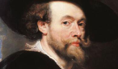
Peter Barber is the Head of Map Collections at The British Library.
Download Transcript

LONDON'S PAST: THE MAPPING OF LONDON 1297-1900
Peter M Barber MA FSA FRHistS
The development of London has been marked by the periodic appearance of an image or map that served as a model for the numerous smaller maps and images that followed over the following years, decades and, in earlier periods, the centuries. These 'milestone' maps and images recorded the appearance and, in later centuries, the plan of the built-up area. But even the later examples, which are rightly regarded as scientific achievements of their times, were not objective records of reality. Certain buildings were named, highlighted by symbols and even depicted, others of the same size were all but ignored. The decoration and text panels also conveyed particular messages about the intentions and values of the mapmakers, their patrons and the society in which they lived. This is most clearly illustrated by comparing these grand maps, with their frequently grandiose visions, with some of the less grand maps produced by contemporaries who had more prosaic objectives. In this talk, I shall illustrate how the image of London evolved from its first appearance as a walled city on a medal on 297 AD to the numerous general, and thematic maps that existed in 1900.
The image of a walled city dominated by its churches endured until the late fifteenth century when, for about 80 years the image was set by a now-lost printed map, possibly created by an Italian in the late 1470s, showing London more or less as it might have looked to a merchant standing atop the mast of a ship arriving in London along the Thames or standing on a fictitious hill east of the Tower. In the late 1550s this gave way to a German-style bird's-eye view map probably commissioned by German merchants of the Hanseatic League based in the Steelyard (on the site of Cannon Street Station) in an unsuccessful bid to win royal support for their attempts to preserve their privileges from attack by a consortium of English City merchants led by Sir Thomas Gresham. Only three of an original 15 copperplates are known to survive from this map, but its appearance is known from a more roughly produced and smaller woodcut derivative, the so-called 'Agas' map of about 1561 (which substituted an English propagandistic message) and from a book-size copperplate map published in Cologne in 1572 (which perpetuated some of the German merchants' texts).
This image endured for almost exactly a century until, in the closing years of the Commonwealth, it gave way to map surveyed by a Somerset squire, Richard Newcourt, which was engraved in the workshop of William Faithorne. Although superficially an objective rendering with the suburbs to North, East and West that had grown up since 1660, ongoing research by Dr David Marsh suggests that the image is of an idealised London, aware of its ancient origins, dominated by its Anglican churches and by well-planted royal gardens and lacking all sign of the defensive fortifications erected during the Civil War.
This image was short-lived and was followed by decades when the mapping of London - interrupted by the disaster of the Great Fire - mirrored the cultural and political divisions of Restoration society. The Bohemian etcher Wenceslaus Hollar struggled, ultimately unsuccessfully, to win support for an enormous ichnographic (bird's-eye view based on a plan) map-view. Meanwhile, following the Fire, leading members of the newly-created Royal Society gave their support to John Ogilby's efforts to create a scientifically surveyed ground plan of the scientifically rebuilt City. This culminated in a handsome, extremely detailed map, published in 1676/7, showing every building in the City. Particular attention was focused on the halls of the livery companies and the homes of the wealthy and predominantly Whig aldermen.
The Whigs were at the time in the political ascendant. By 1682 the tables had been turned and it was the King and the Tories who were in control - though the City had been the last to submit. The decoration of the map of London, Westminster and Southwark that was published in that year by Ogilby's partner, William Morgan, is a work of political propaganda on the King's behalf and was intended for public display. Its decoration includes a portrait of Charles II and a statue of him and another of his father, with the names of the whole of the English and Anglican ruling elite, while in a small text panel, Morgan criticised numerous City livery companies for their failure to subsidise the 1676 map. Based on surveys of Westminster and Southwark of a quality similar to that of the City depicted on the 1676 map, which it incorporated, the cartographic content is nevertheless different. The scale is smaller and amidst the prevailing ground plans, in contrast to the proud austerity of the Ogilby plan, it includes miniature elevations of important buildings and a very accurate panorama to increase its visual appeal.
Nearly 65 years elapsed before the creation of the next great plan of London and Westminster published in 1746. This included almost all of the West End squares that had come into being in the interim, together with the pleasure gardens, the hospitals and the theatres which characterised Georgian England. It was the work of a skilled French-trained surveyor, Jean or John Rocque of Geneva, and probably the most accomplished English-born engraver of the time, John Pine. The map has extraordinary visual appeal, making the Morgan map seem quite provincial. Its French sophistication and cartographic style would also have come as a something of a shock to English viewers. They were not, however, intended to be the map's primary market. The map, produced using the latest techniques and instruments as the accompanying brochure made clear, was intended as a celebration and proof to Europe and the world - and particularly to the French, with whom Britain was then, almost as usual, at war - of the fact that London had surpassed Paris as the largest city in Europe and that England could culturally and artistically hold its own against anywhere in Europe.
By the end of the century, London had grown still more and had a population of approximately one million. Richard Horwood's enormous map, surveyed and published between 1792 and 1799, was the last to depict the whole of the built-up area on one surface and to attempt to show in the same format every single house - a task made easier by the introduction from 1762 of house numbers. If in this respect the map was traditional, its spirit was very different. In the very years that Napoleon famously branded the British as a nation of shopkeepers, the map is dedicated not to royalty, aristocrats or municipal worthies but to the Phoenix Insurance Company which had given Horwood a loan of £500 towards its production costs and it gives prominence to London's commercial and industrial premises.
In the years that Horwood was at work the infant Ordnance Survey had begun to map the environs of London at scales of two and three inches to the mile and between 1805 and 1822 one inch to the mile printed maps derived from them were published. The preliminary maps provided the source for Thomas Milne's precocious - and extremely rare - land-use map of the environs of London of 1800 - the first of its kind in which colours were used to distinguish between various categories of use. Ordnance Survey also produced extremely large-scale maps of London between 1848 and 1851 containing detailed information on ground levels, an essential step towards providing the city with a much needed modern sewers. Because of opposition from commercial mapmakers to what they saw as unfair government competition, however, the maps showed no more than the outlines of the buildings which were included only so that ground levels could be easily located. It was several decades before this opposition was overcome and Ordnance Survey began producing the same quality of large-scale map that they had prepared for other English cities, particularly in the North.
In the meanwhile the field was left open for private mapmakers: as of 1850 John Arrowsmith was contemplating the publication of yet another revised addition of Horwood's map. In the end it was the firm of Edward Stanford Ltd., however, which filled the gap, providing maps at all the scales required by government, business and administration. The Library Map, first published in 1862, provided a detailed, multi-sheet map of the streets of London, including the outlying districts, with some types of information that would not have been found on Ordnance Survey maps and it and Stanford maps at other scales provided the base mapping for the increasing number of thematic maps that were used to investigate an infinity of urban administrative and social problems. It was only at the very end of the century that Ordnance Survey maps began to be generally used for such purposes.
From the lost map of about 1475 to the Horwood Map, the great maps of London were intended to celebrate London. The more utilitarian Ordnance Survey and Stanford maps, however, had predecessors going back to the 1540s, and the talk will also include some examples of these 'lesser' maps - which today, in an age when Google Earth has taken the symbolic role of the great maps, continue to be the sort of maps through which most Londoners and visitors to London come to grips with an enormous and ever-changing city.
©Peter Barber, Gresham College, 15 October 2007
This event was on Mon, 15 Oct 2007

Support Gresham
Gresham College has offered an outstanding education to the public free of charge for over 400 years. Today, Gresham plays an important role in fostering a love of learning and a greater understanding of ourselves and the world around us. Your donation will help to widen our reach and to broaden our audience, allowing more people to benefit from a high-quality education from some of the brightest minds.